Finding Climate Model Data
This case study used climate model data from CSIRO. The six global climate models (GCMs) were dynamically downscaled using CSIRO’s CCAM model of 50 km resolution over the entire globe for the historical period 1971–2005. The GCMs were also downscaled to 50 km resolution for two RCPs (RCP4.5 and RCP8.5) for the projection period 2006–2099. This data was then dynamically downscaled again to 10 km resolution over South East Asia. The data from these high-resolution simulations was extracted by CSIRO for the eight selected sites and provided via a website to be used in the case study.
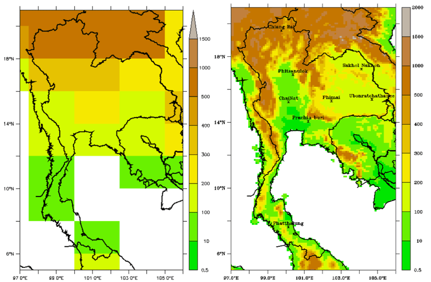
This figure shows the topography of a typical GCM compared to the CSIRO CCAM model at 10 km resolution over South East Asia. The greater detail in the topography (which will have an impact on the local climate) of the high-resolution model is evident. The high resolution of the model also allows more realistic simulation of atmospheric phenomena.