Step 4: Collect Observed Climate Data
Growing conditions are highly localised, so high-resolution ‘surfaces’ of the average climate that account for factors such as elevation (higher ground is cooler than sea level) are needed. Only recent average conditions are needed rather than time series or specific information about extreme events. High-resolution climate surfaces for each month are available from Worldclim (Version 2).
These data provide climate averages for the 1970–2000 period. The high-resolution version has ~1 km² resolution. It uses weather station data and satellite data as input and fills the gaps between data points by using statistical techniques (thin-plate splines and covariates using elevation). All temperature datasets rely heavily on high-quality weather stations with good coverage. The Solomon Islands is not well covered by stations, so the accuracy of the temperature data will not be as high as in some other places. For more information see Fick and Hijmans (2017).
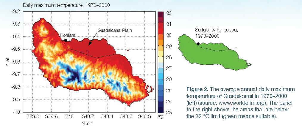
Daily maximum temperature for the Solomon Islands is currently under the limit of 32 °C (Figure 2).
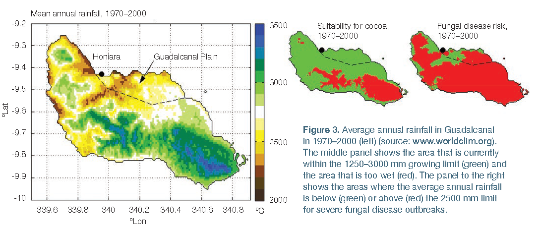
Average annual rainfall is under the 3000 mm limit except in the mountains, but the average rainfall is above the 2500 mm limit for fungal disease in many places (Figure 3).
The Guadalcanal region has between zero and four months with less than 100 mm of rainfall, on average (dry years have more months, wet years have fewer months under the threshold). In an average year, the only area that has four or more months with less than 100 mm is a small area of coast near Honiara.
Reference
Fick, S.E. and Hijmans, R.J. (2017). WorldClim 2: new 1-km spatial resolution climate surfaces for global land areas. International Journal of Climatology 37: 4302–4315.